GPS4CAM is a wonderful tool for geotagging photos taken with a camera without GPS support. You just install an app on our iPhone or Android device and then start a new trip. At the end of your trip you take a photo of one or more QRcode containing all your trip data. The Desktop App will later recognize those QRcodes and adds geotags to the photos.
The only thing I miss is desktop support for Linux. First of all I tried to start gps4cam with wine, but I didn’t get it to work as Java Libraries could not be found. Inspired by this error message I figured out gps4cam.exe as a self-extracting Jar file that could be run on Linux Desktops by typing
java -jar gps4cam.exe

Now gps4cam is running kind of natively on Linux. The next thing was to integrate all the tools gps4cam needs as everything was preconfigured expection tools in Windows Pathes. First of all you need to install dcraw and the perl based tool exiftool.
On Arch Linux type:
pacman -S dcraw perl-image-exiftool
On Debian or Ubuntu based systems type:
apt-get install dcraw libimage-exiftool-perl
Next step is to change the pathes in Preferences in gps4cam. On Arch Linux it looks like that:
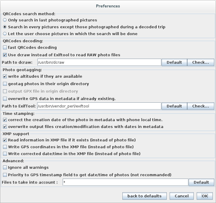
Maybe you need to find the binaries on your system and adjust the locations.
Now you’ll be able to geotag your photos on Linux based systems, too. Enjoy!
Quelle: GPS4CAM and Linux